In the Region of Murcia, the protagonist will be the wind]
We start the week with unpleasant weather in a large part of the Iberian Peninsula and the Balearic Islands.
The passage of successive storms with their associated fronts will cause rain, snow, strong wind and strong waves in our territory, but without affecting all areas equally.
In general, the northern third of the peninsula will be the most affected area, but in the southeast we will also notice it.
Tomorrow, the storm "Gabriel", formed under a process of explosive cyclogenesis, will affect especially the north of the peninsula, although the wind will also be noticeable, weaker, in other areas of Spain.
Wednesdays and Thursdays will continue entering fronts by the northwest of the peninsula, but it will be Friday when we affect the most active, sweeping the entire peninsula.
Unstable weather will continue on Saturday and Sunday will be a calmer day.
From Friday we will also notice a drop in temperatures throughout Spain.
In the Region of Murcia, this situation will be noticed in the form of strong winds of southwest, west or northwest component, according to days.
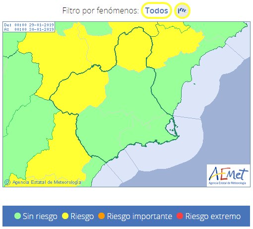
Already today there is yellow warning activated by winds that can reach 70 km / h in the Altiplano and Vega del Segura.
Tomorrow, from 3:00 p.m. until 03:00 p.m. on Wednesday, the yellow warning will affect the Northwest and the Altiplano.
These two areas will be the most affected by the wind in the Region of Murcia until Saturday.
In the rest, although there is no warning, there may also be some strong streak.
But Friday will be the windiest day, day in which wind warnings could be extended to a large part of the Region of Murcia.
The wind will subside on Sunday.
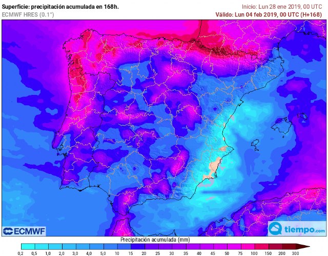
With regard to rainfall, these will be very scarce in the Region, because the winds will be dry.
On Friday, because we will be affected by a more active front, it would be the day when some very weak rains can be registered.
They would be more likely in the mountains of Moratalla and less towards the coast.
The good news is that these fronts leave important rainfall in the headwaters of the Segura River and its tributaries, which will help the reservoirs recover a little.
Temperatures, due to the wind component, will be smooth, both the maximum and minimum, until the front of Friday.
After the front, the wind will turn more to northern component and the temperatures will fall, leaving a cooler weekend.
Civil Protection of Totana will return to inform of this situation in case the wind warning is activated in our region.
Be careful with the wind.


